


It’s easy to understand why so many of us are ill prepared for the Big One. A frank discussion of everything that can and probably will go wrong in a major earthquake is profoundly depressing. So we choose to live in denial. A massive tremor will one day devastate our way of life, yet most of us have done nothing about it. Hundreds of thousands of us haven’t retrofitted our homes. Tens of thousands of us live in death-trap “soft-story” apartment buildings. Thousands more work in old brick and concrete buildings likely to pancake when the ground convulses. And only a scant few of us have realistic plans for what to do when the Big One strikes.
This inevitable catastrophe gets equally short shrift from many of our public officials. When asked for candid assessments of the threats we face from a major quake on the Hayward Fault — the Bay Area rift zone most likely to erupt within the next generation — we’re assured that we are probably more prepared for a major earthquake than any other metropolis on Earth. But are we really ready? How close are we to constructing what some engineers and seismologists call an “earthquake-rugged society”?

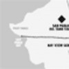
The Hayward Fault: Click here to see the East Bay’s danger spots. Credits: US Geological Survey Slipping or sliding: Click here to see what parts of the East Bay are at risk from liquefaction or landslides after a quake. Credits: US Geological Survey

It’s true that we’re more prepared than we were in 1989, when the Loma Prieta earthquake killed 63 of us and left $10 billion in total damage. But that magnitude-6.9 quake was a lousy barometer. Its epicenter was more than sixty miles away, deep in the southern end of the Santa Cruz Mountains — much too far away to accurately predict how we’ll fare when the Hayward Fault finally rips apart.
A much better indicator jolted the far side of the Pacific ten years ago when a magnitude-6.9 quake rocked the Japanese city of Kobe, which in many ways is a mirror image of the East Bay. That January 1995 quake killed close to 6,500 people and caused at least $150 billion in damage. But according to a report published last month on the Kobe quake’s ten-year anniversary, those numbers don’t begin to completely reflect its long-term impact.
More than 400,000 of Kobe’s buildings were damaged, including 100,000 complete collapses. More than two hundred acres of urban land burned. About 85 percent of the region’s schools, hospitals, and other major public facilities sustained heavy damage. More than 845,000 households were without gas for as much as two and a half months. And water and sewer systems were lost in nearly 1.27 million homes and apartments for as long as four months. Business losses, if possible, were even worse. Unemployment skyrocketed to more than 50 percent, and much of the region’s industrial zone was inoperable for months. Small- and medium-sized businesses went belly-up in record numbers; according to the report, about 80 percent failed.
Structural engineers generally agree that the Bay Area today is in better shape than Kobe was because of building-code upgrades and seismic-retrofit programs. But that doesn’t mean fewer people will die during a similarly strong temblor on the Hayward Fault. Kobe was lucky. Its quake struck before the morning commute, when the vast majority of the city’s 1.3 million residents were still at home. If the Hayward Fault lets loose on a weekday when hundreds of thousands of people labor in seismically unsafe office buildings, the East Bay death toll could match or exceed Kobe’s.
The threat of a big Bay Area quake is not some sky-is-falling prediction. In 2002, a group of scientists led by the US Geological Survey estimated that there is a 62 percent chance of a magnitude 6.7-or-greater quake rupturing one of the Bay Area’s faults in the next thirty years. There is a 27 percent chance of the same-size quake hitting the Hayward and Rodgers Creek faults, which connect beneath San Pablo Bay. The true nightmare scenario for the East Bay is a magnitude 6.9-or-greater quake that would rupture both the northern and southern sections of the Hayward Fault from Point Pinole to Milpitas. The working group put the odds of that quake at about 8.5 percent.
Over the years, several studies have detailed the various disaster scenarios we should expect from a 6.9-or-larger Hayward Fault temblor. The bluntest among them is A Dangerous Place, the final book by the late journalist Marc Reisner. Reading these reports leaves little doubt that the immediate death and destruction from a major quake on the Hayward Fault will be staggering, particularly on the west side of the East Bay hills. But so will the long-term suffering and widespread economic losses. The Association of Bay Area Governments estimates that hundreds of thousands of people will be left homeless. And if the quake hits when the East Bay hills are saturated with rainwater? There will be thousands of landslides, many of which will wipe out entire neighborhoods.
But perhaps the worst place to be when the Big One strikes is in one of our urban centers, which are chock-full of old brick and concrete buildings. “The devastation in our downtowns, such as downtown Hayward and downtown Oakland, will be severe,” said William Lettis, who is one of California’s leading earthquake experts, a member of the USGS working group, and was a main consultant for Reisner’s book. “Certain communities in the East Bay have the potential to become ghost towns.”
Racing against time, several public agencies have made significant strides in the past fifteen years. But a closer look at our vulnerabilities reveals we’re a long way from being ready. Some of it involves bureaucratic foot-dragging that borders on the scandalous. For example, nearly all of the East Bay’s hospital complexes include vital buildings that may collapse or be red-tagged after a 6.9 quake. Meanwhile, death-toll estimates for a 6.9 quake range from the low hundreds up to about five thousand, but many of these predictions omit key hazards. Case in point: None contemplates the destruction of the BART Transbay Tube during rush hour, when three or four trains are inside and more than four thousand riders could drown instantly.
Except for Reisner’s book, most Hayward-quake scenarios also overlook the possible wide-ranging economic consequences for the Bay Area, California, and the United States. For example, a growing number of geologists and engineers are raising red flags about the fragile levees in the Sacramento-San Joaquin Delta. Several of these small earthen dams may slump in a large Hayward quake. And when they do, bay saltwater will rush in and contaminate the fresh-water irrigation supply for five million acres of prime farmland in the Central Valley, the country’s leading agricultural producer. The delta also happens to be the primary water source for 22 million Californians.
Finally, there’s one scenario so frightening that even Reisner chose not to explore it deeply — a major Hayward Fault quake on a hot, windy day in late summer or early autumn. It’s a given that big quakes ignite lots of fires; at one point, there were three hundred burning in Kobe. But in the East Bay, we have the potential for much worse. A series of small fires fanned by hot winds in the densely wooded hills could swiftly grow into a multipronged firestorm. The inferno could easily outstrip the severity of the 1991 Oakland Hills fire and rival the fire of 1906, which enveloped San Francisco following its great earthquake and left the city in ruins.
It’s hard to overstate the dangers we face from building a densely populated society atop an active fault. Some experts believe the Hayward is one of the world’s three fault zones — along with Istanbul and Tokyo — that realistically harbors the potential to unleash truly cataclysmic damage with ramifications for the global economy. Much of this damage will happen not during the quake itself, but in its aftermath.
In the hot seat
In the wake of any disaster, the first people in the hot seat are emergency dispatchers. Ask them, and you’re liable to hear about one of their recurring nightmares. In the first seconds and minutes after a major quake, their communications system will be brought to a standstill by clueless callers who have no legitimate reason to dial 911. “You’d be surprised how many people will call to ask: ‘Are we having an earthquake?'” said Bill McMurray, president of the National Emergency Number Association and head of the Marin County emergency dispatch center.
But even without these hundreds or thousands of unnecessary calls, the East Bay’s emergency dispatch centers will be overwhelmed. There simply won’t be enough staff to handle the flood of calls after a major quake. “Nobody is staffed to equip a cataclysmic event,” McMurray admitted, noting that such preparedness would break any public agency’s budget.
Calling 911 in those first few seconds or minutes also may frustrate even the most determined among us. In past years, placing a call after an earthquake was never a major concern, but it’s now a front-burner issue. The reason? Cordless phones. Unlike old landline phones, cordless phones require electrical power. But widespread outages always accompany big quakes. “If you don’t have a landline phone, you better hope your next-door neighbor does,” said Regina Costa, telecommunications director of the Utility Reform Network, a consumer-advocacy group.
Once the insanely busy dispatchers start sending firefighters and paramedics into the streets, the East Bay hills will be ground zero. But getting there could mean navigating a giant obstacle course. “Every road from San Pablo Bay to Milpitas that crosses the Hayward Fault is going to be knocked out,” explained Jeanne Perkins, an earthquake expert with the Association of Bay Area Governments.
The reason is ground displacement, and in a Hayward event it will be substantial. In essence, everything west of the Hayward Fault will suddenly lurch northward an average of three to nine feet. All the roads into and out of the East Bay hills will be ripped apart. And so may every overpass and underpass on state Highway 13 and Interstate 580, effectively severing the link between residents of the Oakland and San Leandro hills and the outside world.
The Association of Bay Area Governments expects 1,734 road closures in all, including every major East Bay freeway. Highway 13 and I-580 both cross the fault line repeatedly and will rupture in each spot. The ten-lane Highway 24 will split in two where it bisects the fault several hundred yards from the western mouth of the Caldecott Tunnel. Miles-long sections of our waterfront freeways, Interstates 80 and 880, could be undrivable for days or weeks when the ground beneath them suddenly liquefies.
Buried under the roads and running from house to house lie hazards that could turn a major quake into an even larger disaster. Dozens, perhaps hundreds of gas lines will crack open and spew flammable fuel into the air, just as overhead power lines snap and sparks shower to the ground. The good news is that pipeline fires tend to flame out on their own. Unless, of course, the quake hits in late September or October, when hot Diablo winds are roaring through our dry canyons. The 1991 East Bay Hills firestorm, which killed 25 people and destroyed nearly three thousand homes, would be little more than a warm-up act compared to a tragedy of this magnitude.
Many hard lessons were delivered by that October disaster. Among the most important was the need for unfettered communication between firefighting agencies. At the time, the Oakland and Berkeley fire departments couldn’t talk effectively with each other, thereby crippling what should have been a quick response to a fire that possibly could have been controlled. But more than thirteen years later, that lesson has yet to be heeded. Oakland and Berkeley still use noncompatible radio systems. And neither one of them can easily communicate with the Alameda County Fire Department, which in turn uses radios incompatible with the East Bay Regional Park District Fire Department and the California Department of Forestry and Fire Protection. “It’s a significant problem,” said county Fire Chief William McCammon, who has launched an effort to convert all fire radios to a compatible countywide system.
As significant as this problem was in 1991, it could be geometrically worse after a major displacement of the Hayward Fault. According to a study prepared for the East Bay Municipal Utility District in the early 1990s, the utility’s service area will experience between 85 and 255 fires in the moments after a 7.0 quake, with the likely number being 170. East Bay fire departments simply do not have enough firefighters, trucks, and hoses to simultaneously fight 85 fires, let alone 255. And even if they did, they will face a shortage of the one weapon they’ll need most — water. In the first few hours after the quake, firefighters will be left holding limp hoses, impotent to do anything about the fires raging in front of them.
The main water supply for communities from El Cerrito south to Castro Valley flows through EBMUD’s giant underground Claremont Tunnel, which was built in the 1920s with unreinforced concrete. Three feet of displacement on the Hayward Fault between Orinda and Berkeley will be just enough to sever the tunnel, fill it with mud, and close it down. And when that happens, 840,000 of EBMUD’s customers will be on severe water rationing for six months — and fighting scores of fires will basically be impossible.
John Eidinger, a leading expert on public utilities and earthquake engineering whose Oakland-based company produced the report, gives high praise to EBMUD and its $189 million seismic-retrofit program. Since last June, EBMUD has been building a short bypass tunnel across the nine-hundred-foot-wide fault zone. This new tunnel is designed to withstand a 7.0 quake. But even after the project’s scheduled completion twelve to fifteen months from now, fighting fires remains a hit-or-miss proposition. The reason has to do with the small, old water pipes EBMUD still has in service. “There are two hundred miles of pipe in liquefiable soils and a hundred miles in soils with active landslides,” Eidinger said.
Smaller pipes that cross the fault are going to rip apart too. Eidinger’s report estimated that EBMUD would experience between 3,250 and 5,500 pipe breaks in a 7.0 Hayward event. That’s very bad news for firefighters. Water flowing out of those broken pipes will cause the system’s pressure to plummet to little more than a trickle in pockets throughout the East Bay.
A choice of disasters
If the Big One strikes on a calm or rainy winter day, many of those fires might burn out without spreading. But that won’t let firefighters off the hook. They don’t just fight fires; they’re also frontline rescuers. “The East Bay hills, especially North Berkeley, Albany, and Kensington, are going to be heavily damaged by landslides if it occurs in the winter,” Lettis said. “There will be thousands of landslides in the East Bay hills area, including the Orinda hills and the Lafayette hills. And hundreds of them are going to be large enough to take out a house.”
Back in the dispatch centers, emergency workers will have to decide whether they should send firefighters to fight fires, pull hillside residents from beneath landslides, or search for missing people in the hundreds or thousands of buildings that will pancake. Despite efforts in the past decade to retrofit them, there are still hundreds of dangerous unreinforced masonry buildings, many of them brick, in downtown Hayward, Oakland, and Berkeley. Nearly as menacing are the hundreds of unreinforced concrete buildings and concrete tilt-up structures that were built prior to the major building code overhaul in 1976. Lettis, one of a breed of scientists who hopscotch around the world immediately after earthquakes to examine their effects, has witnessed firsthand what happens when midlevel floors in a building pancake to less than an inch in height: “You say to yourself, ‘Holy smokes, these people had no idea what was coming.'”
Possibly the biggest hazard are 1950s- and 1960s-era apartment buildings built atop first-story parking garages or retail stores. “They have these spindly little columns, a lot of parking, and a very heavy box sitting above that,” said Mary Comerio, an architecture professor at UC Berkeley who is an expert on the structural risks to homes and buildings. These so-called soft-story structures are common throughout the East Bay, especially in Oakland, Berkeley, Hayward, and unincorporated communities of Castro Valley, Ashland, and Cherryland. The precise number of them is unknown. The Oakland-based Earthquake Engineering Research Institute estimated that we have at least fifteen thousand. But Berkeley is one of the few cities that actually has counted how many it has — about four hundred. “Most of these buildings will be heavily damaged, or the first floor will just pancake down and kill people,” Lettis said.
Oakland is home to a nationally accredited Urban Search and Rescue Team, but it will be impossible for the team to be in more than one collapsed building at a time. The same is true for the three well-equipped heavy-rescue teams in Alameda County (fire departments in Fremont, Oakland, and Alameda County all have one). And even after rescuers start extracting the seriously injured from the rubble, there may be no place to take them.
Ambulances could roll up to both of the county’s trauma centers, the only hospitals equipped to treat the most seriously injured, and be greeted by huge piles of bodies and rubble. At one of those, Highland Hospital in Oakland, four of the five buildings are at risk of collapse in a major quake, according to a 2001 in-depth analysis by the California Office of Statewide Health Planning. At the other, Eden Medical Center in Castro Valley, six out of ten buildings could be knocked down.
In fact, the East Bay’s hospital complexes have the potential to become their own disaster zones, with paramedics pulling people out instead of driving them in. Eleven of the twelve buildings at Kaiser Oakland could topple, as could both of the buildings at Fairmont Hospital in San Leandro. Two of seven buildings at Children’s Hospital in Oakland and three of eleven at Kaiser Hospital in Hayward also could collapse. According to the report, 39 of the total 108 hospital buildings in Alameda County are at risk of falling down in a major quake.
Not all of these buildings will probably collapse, but that doesn’t mean they’ll be usable. Dozens of hospital buildings may be too hazardous to occupy and damaged beyond repair. Five of the eight buildings at Alta Bates Hospital in Berkeley fall into that category, as do two of the four at St. Rose Hospital in Hayward. If a major quake hits before they are retrofitted or replaced, more than half of the hospital buildings in Alameda County — 57 — may either be red-tagged or no longer standing.
And there are no easy alternatives. Impassable roads could stymie efforts to transport the seriously wounded to trauma centers outside the region. Local fire departments and paramedics could be left to battle the disaster for a few days on their own. “It’s a big problem; it’s a big issue,” acknowledged Rich Eisner, the Bay Area coordinator for the Governor’s Office of Emergency Services.
The state probably will attempt to fly in medical teams from outside the area. “They will set up in hospital parking lots, like MASH units,” said Barbara Center, regional-disaster medical-health specialist of the state’s Emergency Medical Services Authority. For patients who need long-term care, the state may attempt massive airlifts to fly them to hospitals around the country, Center said. Helicopters are impractical because there aren’t that many of them and they can take only two patients at a time, she added.
Where will you be?
A favorite mantra of earthquake safety experts is: “Be prepared to be on your own for 72 hours.” It’s one of those sayings that has been repeated so often that most of us ignore it, or don’t know what it really means.
If the quake hits during the workweek, hundreds of thousands of East Bay residents will be on their own in San Francisco. The city may emerge relatively unscathed if the quake centers on the Hayward Fault’s northern section, according to computer modeling cited by structural engineer and risk-assessment expert Ronald Hamburger. But if the epicenter is on the southern end of the fault and the shock waves pulsate northward? “A rupture on the southern section, going from south to north, just creams San Francisco,” Hamburger said.
The best time of day for a big quake is at night, when fragile concrete or masonry office buildings are empty and many people are at home in the relative safety of their wood-frame houses. If we’re lucky, the death toll could be in the low hundreds. At the opposite end, the worst time in most earthquakes is typically about 2 p.m. on weekdays, when statistics show most people are back from lunch and at their desks, said Perkins of the Association of Bay Area Governments. But in the Bay Area, the real witching hour would probably be during the morning or evening commute. During rush hour, thousands of cars likely will be idling on the Bay Bridge. If a major Hayward Fault event occurs before the eastern span of the bridge is replaced, structural engineers agree it will break apart and collapse. When it does, hundreds, if not thousands, of people will plunge to their deaths.
At the bottom of the bay, the scene could be even more horrifying. If the quake strikes in the next five years before the BART tube is retrofitted, the underwater tunnel probably will rip open and flood. During rush hour, there are typically three or four trains speeding through the tube at any given time with a thousand or more riders on each, said BART’s earthquake manager Thomas Horton. There’s little hope that any of those people will survive.
Commuters in downtown San Francisco who were lucky enough to have missed their trains will have to dash up the stairs and escalators. It’s not clear how fast it will happen, but every downtown BART and MUNI station all the way to 16th Street is below sea level and will flood from top to bottom. And because of the giant web of underground connections beneath San Francisco, every downtown basement and garage will be flooded with brown bay water, too, Hamburger said.
The other half-million or so commuters will be stranded for quite some time. Many will have to roam the streets of San Francisco in search of water, food, and shelter. “If you work in San Francisco and you live in the East Bay, you should be prepared to be homeless for at least 72 hours,” Lettis said.
Ferries could eventually take transbay commuters home — assuming, of course, that they have enough fuel. But motorists will endure a more difficult time. Although nearly all of the other bridges that span the bay have been seismically retrofitted, most of the roads and freeways leading up to them will liquefy. It could take Caltrans several days or weeks to repair all of them.
The long-term economic effects of losing both the Bay Bridge and the BART tube are difficult to comprehend. About 150,000 people commute through the tube each day, and about 280,000 cars cross the bridge. It could take two to three years to construct a new tube, and twice that long to build a new eastern bridge span.
The resulting gridlock will be unimaginable. A traffic analysis published in October by UC Berkeley researchers offers a partial glimpse of what we’ll face if we lose just the tube. The average speeds on city streets in Oakland and Berkeley during morning commute hours, for instance, will slow to one to two miles per hour. “The same is true for the San Francisco street network in the evening,” the report states. “It is likely that drivers will spend one to two hours to get to the closest freeway and then spend an extra couple of hours … to cross the bridge.” East Bay freeways will be no better. For example, the average morning commute on I-80 from Hercules to Emeryville, a distance of sixteen miles, will take three and a half hours. It will take almost as long to inch along the ten-mile stretch of Highway 24 from Walnut Creek through the Caldecott Tunnel, which is expected to survive, to Highway 13 in Oakland.
And that study assumes that the BART tunnel connecting the Rockridge and Orinda stations will be operable. But it won’t. The twin tubes of the Berkeley Hills tunnel cross the Hayward Fault, and BART expects them both to be knocked out. A 2002 study by Bechtel estimated that it could be five months before BART can send a single-track, slow-moving train through one of the tunnels, and up to 28 months to restore normal service to both.
Of course, getting to and from work may be one of the last things on people’s minds. For the roughly 360,000 people that the Association of Bay Area Governments expects to be left homeless, finding potable water and temporary shelter will be tough enough. At the time of the Northridge quake, the rental housing vacancy rate in the San Fernando Valley was 12 percent, so moving people into other apartments wasn’t too difficult, Eisner said. The bad news for the Bay Area is that we traditionally have much lower vacancy rates and there will be a huge loss of housing.
The association estimates that about 156,000 homes and apartments will be uninhabitable. Those who can afford it least will be hit hardest. Flatland residents in the poorest neighborhoods of Berkeley, Oakland, and south through Hayward, for example, either live in collapse-prone, soft-story apartment buildings or in older single-family homes that will fall off their foundations. “None of those buildings has been retrofitted,” Comerio said. “None.”
When you live paycheck to paycheck, the cost of bolting a house to its foundation and adding a cripple wall can be prohibitive. And it’s even more expensive to buy earthquake insurance. After the Northridge quake, big insurance companies threatened to leave California if the state continued to require them to offer quake coverage. The Legislature acquiesced and created the California Earthquake Authority as an alternative. But only 15 percent of California homeowners now have earthquake insurance because CEA premiums run $1,000 to $2,000 a year and the typical deductible on a $300,000 home is $45,000, said authority spokesman Steve Devereaux.
Past experience shows that many people forced from their homes will not want to go far. Many will simply pitch tents on their front lawns so they can protect their belongings from looters, Eisner said. But camping out creates public health problems because of the lack of working water and sewer lines. As a result, government emergency-response agencies plan to bring in mobile homes from around the country and attempt to steer residents into temporary cities with water and portable toilets. In Kobe, nearly fifty thousand temporary homes were constructed after the quake, and many were still in use four years later.
Many of the 156,000 uninhabitable homes will suffer only minor damage and shouldn’t be out of commission for long. But convincing people to move back in after they’ve been inspected and cleared is another matter. In Northridge, thousands were too afraid to return to houses and apartments riddled with cracks — a common side effect of quakes but not a true indicator of structural integrity. Authorities had to create “Reassurance Teams” made up of building inspectors and clergy, church, and neighborhood groups to coax them into going home, Eisner said.
Meanwhile, the hundreds of thousands of residents lucky enough to remain in their homes after the quake will face their own set of headaches. It could be days or weeks before electricity and water are restored. Same for sewer systems. And though the bay is not typically considered a flood zone, there could be widespread flooding if the quake hits right before or during a heavy rainstorm. Antiquated storm drains will break where they cross the fault line or will be choked off by flowing debris.
And for those of you who turned off your gas right after the quake to avoid a fire, be prepared to go without gas for cooking or hot showers for two to three months unless you know enough to turn it back on yourself. Pacific Gas & Electric anticipates its crews will have to individually inspect and relight pilot lights in hundreds of thousands of homes. That’s why California utilities and many fire departments strongly urge people not to turn off their gas unless they smell a leak.
Not that you’ll have a lot to cook anyway. Widespread food and bottled-water shortages are a certainty. Impassable freeways and damaged rail lines will make it difficult for trucks and trains to deliver goods from outside the region. And several of the older wharves at the Port of Oakland may be inoperable when the mud beneath them liquefies. The good news is that during its $1 billion maritime expansion in recent years, the port built several new wharves designed to remain functioning after a big quake, spokesman Harold Jones said. But what good are new wharves if trucks and trains can’t get to them because of liquefied roads and rail lines along the waterfront?
Flying in food and medical help won’t be easy either. The runways at Oakland International Airport will likely liquefy, and it could be days or weeks before they’re repaired. And even when they are, I-80 also will be damaged by liquefaction. In all, the Association of Bay Area Governments says that some 1,095 miles of roads and freeways in Alameda County alone have a “high” or “very high” susceptibility to liquefaction.
As the US economy becomes more and more dependent on imports, the long-term economic losses to the Port of Oakland and Northern California are hard to quantify. It depends on the total damage to the seaport, which is the fourth-busiest container port in the nation. Jones said the port has set aside $47 million for emergency post-earthquake repairs, plus it can tap into hundreds of millions of dollars currently earmarked for capital improvement projects. But, in today’s hypercompetitive, import-export economy, Oakland faces the prospect of losing valuable business to other West Coast ports if it cannot return to full operations quickly.
Kobe has yet to completely recover. Japan’s leading container shipping port suffered heavy losses and it was nearly a year before repairs were finished, according to a report by Risk Management Solutions, a Newark-based company that specializes in estimating losses following major disasters. Shipping companies just couldn’t wait for Kobe to return to normal, so they turned to other Asian ports to bring their goods to market. Much of that business did not return.
What’s still not done
Few experts believe that the East Bay will suffer as much structural damage in a Hayward Fault eruption as Kobe did during its 1995 quake. We have far more single-story houses and far fewer tall buildings and large concrete apartment complexes. The overhaul of California’s Uniform Building Code, which took effect in 1976, also means that our newer buildings — and any older ones that have been substantially remodeled — will perform well. And local seismic-safety efforts, such as the construction of a new Hayward city hall and the retrofit of city halls in Oakland and Berkeley, will ensure that many of our public buildings will survive intact.
In short, we’ve done a lot. But we’ve also left a lot undone.
One Bay Area city stands out for its steadfast refusal to be overwhelmed. Berkeley knew it had unsafe schools, so it openly identified them and then fixed them. The city also upgraded its fire stations so the garage doors won’t jam when the ground begins to shake. About 630 of the city’s 700 unreinforced-masonry buildings have been retrofitted. And its tax incentives have resulted in the retrofit of 60 percent of its single-family homes. To help pay for it all, Berkeley’s homeowners basically taxed themselves silly. “Berkeley is in better shape than any other city,” said Perkins, who keeps tabs on the seismic programs of every community in the nine-county Bay Area.
Berkeley also is about to unveil a proposal that would require landlords to shore up the city’s soft-story buildings. “Most people just aren’t aware of how fragile they are,” said assistant city manager Arrietta Chakos, Berkeley’s earthquake czar. Berkeley has similar plans for the city’s 85 to 100 concrete tilt-ups or buildings of unreinforced concrete.
The Berkeley Fire Department also has a plan for when the water shuts off. In 1992, voters agreed to spend $30 million on a proposal for piping water from the bay to battle blazes in the hills. But when fire officials realized the plan had become unwieldy and much too expensive, they scrapped it, went back to the voters, and said they didn’t need the money. “We realized it would never be built,” said Deputy Fire Chief David Orth. Instead, the department devised a cheaper, $8 million plan, to purchase a state-of-the-art mobile water system of giant hoses and pumps. That way, firefighters can pump and spray water from the Strawberry Canyon swimming pools, Lake Anza, or an EBMUD tank reservoir.
But Berkeley fire officials don’t suffer from overconfidence. They realize, for example, that their mobile waterworks may be no match for a quake-ignited firestorm, and they know they’ll be quickly overwhelmed when the Big One hits. “We’ll have difficulty getting to the fires, troubles getting there because of all the other calls we’ll get, and when we get there we may not have enough water,” Orth said. The city currently has about 34 firefighters on duty at any given time, plus another ten or so live nearby, Orth said. In other words, there will be only about 45 firefighters available to cover an entire city full of landslides and collapsed buildings. (The rest of the hundred or so of the total force live outside the area and likely won’t make it in for a few days because of all the road closures.)
To add to its firefighting and rescue capabilities, the department has turned for help to neighborhood groups. After soliciting competitive bids, the department recently placed caches of equipment and supplies in eight neighborhoods — one for each city council district. The caches will allow trained neighborhood groups to fend for themselves with the hope that they may stop a single house fire from growing into a conflagration.
But Berkeley is not alone. Other public agencies have made significant seismic improvements since Loma Prieta. Among them is UC Berkeley, which is knee-deep in its own massive retrofit and building-replacement program following a 2000 study that revealed that campus was riddled with unsafe concrete buildings. PG&E, meanwhile, has spent $1.2 billion in the past two decades replacing old underground gas lines and strengthening its Claremont substation, which basically straddles the fault. EBMUD’s $189 million seismic program is almost complete, and the utility also plans to spend up to $100 million fortifying the San Pablo Reservoir, which has been partially drained because its dam is expected to slump and flood El Sobrante in a major quake.
BART, meanwhile, is embarking on a $1 billion retrofit plan — after Bay Area voters approved a bond measure in November. BART plans to secure the Transbay Tube and harden 1,983 aerial columns that may collapse or sag in a quake. The most vulnerable are on liquefiable soils in West Oakland and along much of the Richmond-to-Fremont line. However, BART has decided against retrofitting the Berkeley Hills Tunnel, saying it would be too expensive and cannot be done without closing down the twin tubes.
Except for the total meltdown over the Bay Bridge’s eastern span, engineers generally praise Caltrans for retrofitting or replacing nearly all of the Bay Area’s other toll bridges. The Richmond-San Rafael Bridge is the only other one not yet completed. Caltrans also has gone to great lengths to shore up dangerous overpasses and major interchanges. Now, those structures likely will remain upright in a major quake. However, heavy ground shaking or liquefaction could still leave them unusable immediately afterward.
Some hospitals, too, are beginning to retrofit and replace vulnerable buildings. Just don’t expect to see much progress anytime soon. “There’s a large group of hospitals that have asked for extensions,” admitted Chris Tokas, manager of the California Hospital Seismic Retrofit Program. There have been 203 to be exact, and the state has granted or will grant nearly all of them, according to state records. There likely will be plenty more extension requests, too — hospitals have until 2007 to make them. The requests are permitted under the same 1994 law that required hospitals in California to fix or replace the 975 hospital buildings at risk of collapsing. And the extensions allow hospital owners to put off finishing those projects from 2008 to 2013. East Bay hospitals that have received extensions include Highland, Fairmont, Kaiser Oakland, Children’s Hospital, and Alameda Hospital.
But even with the extra time, the hospital industry isn’t happy. Cost estimates to meet the 2013 deadline range from $20 billion to more than $80 billion. “There have been complaints, no question about it,” Tokas said. Still, hospital owners will have another 25 years, or until 2030, to retrofit or replace buildings that may be too damaged to inhabit or repair after a major quake. In that category statewide, there are another 502 buildings.
Federal Emergency Management Agency computer modeling estimates that we’ll suffer $23 billion in building-related losses from a 6.9 Hayward Fault rupture. And while educated guesses such as these are essential for disaster-response planning, the truth is we really just don’t know how bad the damage will be with any certainty. How can we when we don’t know how many soft-story and old concrete buildings there are in the East Bay? Or how many school buildings are at risk? Or how we’ll deal with the collapse of the Delta levees and the massive loss of water to our farms and Southern California households?
We still have plenty of work to do. Five years ago, a survey by the Association of Bay Area Governments found that fewer than 20 percent of single-family homes in Oakland and Alameda had been retrofitted. The numbers were less than 10 percent in other communities such as San Leandro and San Lorenzo. Berkeley has been the runaway leader with more than 60 percent retrofitted, mostly because of its property transfer tax rebate. But even that program could have holes because there may have been inadequate inspections of the work performed, Perkins said.
Despite the glaring dangers, earthquake preparedness simply isn’t a top priority for many public agencies and local leaders. Take the 911 cell phone system. The Federal Communications Commission mandated that cell-phone providers offer the technology for 911 cell calls to be routed directly to local police and fire departments by the end of this year. Most have already complied, yet the vast majority of local agencies are not taking advantage. In Alameda County, only the cities of Emeryville and Piedmont have done any rerouting. And in Contra Costa County, only Antioch, Martinez, and Pleasant Hill have made progress.
It’s no different in Sacramento. It’s not unusual for seismic-safety legislation to be met with a fair amount of ridicule, with the bill’s author viewed as if she or he were some sort of Chicken Little. “Our politicians simply don’t acknowledge that this disaster is right around the corner,” Lettis said. “It’s not maybe it will happen; it’s going to happen.”
A major quake on the Hayward Fault will prove why we should have been paying more attention.
The Danger of the Delta
A major East Bay quake could jeopardize the drinking water for 22 million Californians.
Water reigns supreme in California. It’s easily the most important commodity in this arid, densely populated state of ours. Yet many of us take it for granted. And few of us realize that at any time it could be shut off.
Historians someday may look back and just shake their collective heads. How could the world’s fifth-largest economy be so reliant on a water-delivery system that is so vulnerable? And how could so few people know that the Sacramento-San Joaquin Delta, the most vital cog in that system, could be destroyed when the Earth begins to shake?
“One of the hidden scares of a major earthquake on the Hayward Fault is the damage to the levees in the delta,” said William Lettis, an earthquake expert who has been issuing warnings about the delta for years. “It could have absolutely devastating consequences on California’s economy.”
A popular destination spot for twelve million visitors each year, the delta is roughly the size of Rhode Island, spanning 738,000 acres of farms, small towns, open space, and lots of water. It’s the confluence of the San Francisco Bay and five mighty rivers — including the Sacramento, the San Joaquin, and the Mokelumne — that carry nearly half of the state’s total runoff.
The farms in the delta are called “islands.” Sixty in all, they were carved out of the natural tule marshlands during the 19th century, mostly by Chinese laborers. The islands are protected by more than 1,100 miles of levees — poorly constructed earthen dams that keep the salty bay water from inundating the farms. They also stop that brackish water from contaminating the freshwater that flows in from the rivers.
The levees were not only badly engineered, they’re vastly overworked, and their job is getting harder. The islands they surround are sinking. Some have subsided to an average of 26 feet below sea level. It turns out that farming the islands’ soil, organic peat, causes it to oxidize and blow away in the wind. This adds stress on the levees, which are already pounded each day by windswept bay water. To make matters worse, global warming is raising the sea level about two millimeters a year, according to Jeffrey F. Mount, the director of the Center for Integrated Watershed Science and Management at UC Davis.
The strain on the levees is so strong, they can collapse on their own. Last June, a levee protecting the Upper Jones Tract Island broke open and bay water flooded about 12,000 acres west of Stockton, causing about $100 million in total damage. But it was not an isolated incident. Seventeen delta islands have flooded in the past 25 years.
A major Hayward Fault earthquake could slice through the weak levees like “the sword of Damocles,” said Mount, a geology professor who has studied the levees extensively. The most vulnerable are the westernmost islands in Contra Costa County closest to the fault. The collapse of just a few could create a domino effect. Mount explained why: The bay-water sides of the levees were built stronger because there is more daily pressure on them. But when a levee breaks and floods an island, the water pressure is transferred to the weaker inside of the next levee. That next levee, then, becomes much easier to topple.
Nature abhors a vacuum, and the collapse of eight levees in a row is called the “Big Gulp.” So much saltwater will rush in that it will ruin the delta’s freshwater supply, possibly for up to a year or more. “It turns out that once it gets in, it’s hard to get out,” Mount said. He explained that there’s only one construction company in California that repairs levees — the Dutra Group. Under perfect conditions, Dutra can fix two to three levees in the course of a summer. But working from barges while battling wind-driven delta waves is devilishly difficult, and the company likely will be under fierce pressure to be elsewhere. “If you have a 7.0 earthquake on the Hayward Fault, do you think that Dutra Corporation is going to be out fixing the delta?” Mount said.
That’s very bad news for California. The delta is the main drinking-water source for 22 million people. While it mostly supplies Southern California via the State Water Project canal, it also is a primary source for Contra Costa and Santa Clara counties and the main irrigation water supply for five million acres of cropland in the country’s leading agricultural area, the San Joaquin Valley.
Major aqueducts in the EBMUD and Hetch Hetchy water systems also are at risk where they cross the delta. If it suddenly becomes a giant inland sea, those aqueducts will be torn apart. EBMUD is currently studying whether it’s possible to fix its main water supply, the Mokelumne River Aqueduct, from barges.
What happens when the water is too salty to quench the thirst of more than two-thirds of California’s residents and much of its best farmland for a year or more? California has never completed a comprehensive study of the likely long-term economic effects on the state, the nation, and the world’s economy. Tens of billions of dollars? Hundreds of billions, perhaps? Whatever it turns out to be, it will pale in comparison to the $1 billion or so that Mount says it would cost now to sufficiently fortify the old levees.
The Shame of Our Schools
More than 7,500 schools may fail in a quake, but the state won’t reveal which ones.
Not long after Loma Prieta, Arrietta Chakos started wondering about the safety of the old school building she sent her kids to each morning. So the Berkeley mom asked the school principal if the building had been retrofitted and if the school had a disaster plan. “The principal pulled out a box of five hundred Band-Aids and said, ‘This is our disaster plan,'” she recalled.
Fifteen years later, parents throughout California may be horrified to learn, as Chakos did, that many of their kids’ schools have not been retrofitted. Unlike hospitals, there is no state mandate to fix antiquated school buildings that could pancake in a major earthquake. There is not even a requirement that school districts know which of their buildings are likely death traps.
In the late ’90s, then-Assemblywoman Ellen Corbett learned that the state did not know either. So the San Leandro Democrat wrote a bill that authorized a detailed study by the Division of the State Architect.
Nowadays, it’s no mystery as to which buildings tend to fall down in a quake. New and wood-frame buildings are generally safe; old concrete and brick buildings are not. So the structural engineers chose to analyze only the architectural plans of non-wood-frame buildings constructed or remodeled before the 1978 state building code upgrade for schools. In all, they examined the plans for 9,659 school buildings.
Their report was completed in 2001, but the administration of then-Governor Gray Davis kept the results under wraps for a year, and then attempted to downplay the findings, presumably because they were so startling. The report found that 78 percent of the buildings — 7,537 — were “not expected to perform well in future earthquakes” and should be inspected more closely to determine whether they would likely kill children. Worse, 1,229 of those buildings were less than two kilometers from an active fault. But the topper was that the report did not identify the individual schools at risk. Corbett had been forced to insert language into her bill mandating that the report not reveal school names and locations.
“When I heard that this information was suppressed, I couldn’t believe it,” said Chakos, who is now a Berkeley assistant city manager and is the city’s earthquake guru. “We require our children to be in those buildings.”
Corbett, who was termed out of office in December, said there may have been “cause for concern of some panic” if parents found out they were dropping their kids off every day at seismically unsafe buildings. There also was speculation that the administration was worried about exposing the state to legal liability. Corbett’s bill said only that school districts could get the names and locations of the buildings if they asked.
Some public school districts have been open and forthright. In the ’90s, Berkeley identified its schools, and its voters readily agreed to pay for the retrofits. Fremont has done the same. But they’re in the extreme minority. More than two years after the report was released, only about “seventy or eighty” of the state’s nearly one thousand school districts have even requested the names and locations of their potentially dangerous buildings, said Dennis Bellet, the chief structural engineer for the state architect’s office.
Some have speculated that the school districts are purposely ignoring the problem. “It’s a mysterious line of thinking — if you don’t know, you’re not responsible, or that it will reduce your liability if you don’t know,” said Tom Tobin, the former executive director of the California Seismic Safety Commission. “I think that’s a bogus argument.”